MysteriesEye of the Sahara and AtlantisArtifactsKircher's map of Atlantis (Mundus subterraneus, 1665)
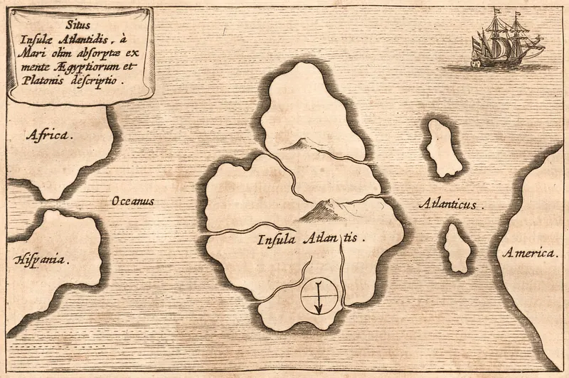
Wikimedia Commons file, public domain. Commons credits it to Mundus subterraneus, vol. 1, Amsterdam, and dates it 1664 in its description and 1678 in the file name; the Internet Archive copy of the first edition is dated 1665.
The earliest drawn map of Atlantis this review found: an island in the Atlantic, drawn with south at the top, between Africa and Spain and America.
Athanasius Kircher. Public domain
Copies 1
Kircher's atlantisAthanasius Kircher · commons.wikimedia.org · 1665 · Public domainPrimary source: Mundus subterraneus, in XII libros digestus2 steps from the original

Sources 1
Cite it
Mysteries Department. (2026). Kircher's map of Atlantis (Mundus subterraneus, 1665) [Artifact ART0DCP8BWPR5V2]. https://mysteriesdept.com/r/ART0DCP8BWPR5V2
@misc{mysteriesdept_art0dcp8bwpr5v2,
  title     = {Kircher's map of Atlantis (Mundus subterraneus, 1665)},
  author    = {{Mysteries Department}},
  year      = {2026},
  note      = {Artifact, catalog key ART0DCP8BWPR5V2},
  url       = {https://mysteriesdept.com/r/ART0DCP8BWPR5V2}
}